Pilotage
VISITORS - Please contact the Sailing Club prior to arrival, if possible, to arrange berthing on pontoons. For arrival by sea to Burnham on Sea Motor Boat and Sailing Club please consult your nautical almanac and Admiralty Chart 1152. Notices to Mariners are available for the current edition only. If you have a copy of the Blue Book, produced by the Bristol Channel Yacht Conference you will find us in there.
This page is best viewed on a larger screen

1.
Entry should be considered in fair weather only, shallow waters and strong winds can lead to breaking water on the approach. Navigators should regularly monitor their depth and stay in the deep water channel.
Passage should be made to arrive at the Gore Bell, coming from the West, between HW-2 and HW. Ensure you are in the River Parrett no later than HW+1, unless you are familiar with the waters. The chart shows the deep water channel although sandbanks can alter. Be aware of No1 port RED bouy approx 2 nm from Lower Light , and No 2 starboard GREEN buoy inside the River Parrett. Burnham Lower lighthouse is visible, the Upper lighthouse (disused) is also clearly visible. You will see transit lines from Burnham Church Tower and a red line on the sea wall.
Entry also possible either by entering North Channel, or via Bridgwater Bar and No 1 Buoy . Always consult the latest chart (3rd Edition), current almanac, tidal heights, weather forecasts, echo sounder, and chart plotter.
The channels remain as shown on the Admiralty chart, though the channels may be subject to change. There are drying banks to the north of the North Channel 3.8 m, across Larks Spit 5 m, and to the south of the West Channel 6.3 m, as shown under section 2 that follows.

2.
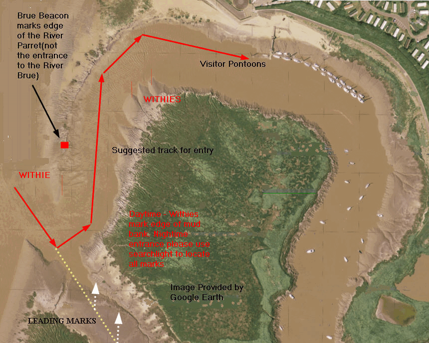
Entry in to the River Brue, see illustration below, is indicated by the Brue Beacon, and leading marks on the far bank. Withies are inserted in to the sea bed to indicate shallow water. Mooring is available to visitors on the first set of pontoons. Water, electric, toilets, showers, clubhouse, available. Pontoons accessible between HW+2 and HW-1

3.
From main channel of River Parrett observe edge of channel light named Brue Beacon, look for leading marks in to River Brue, be aware of mud banks. Withies indicate shallow water. Monitor depth at all times on entry.

4.
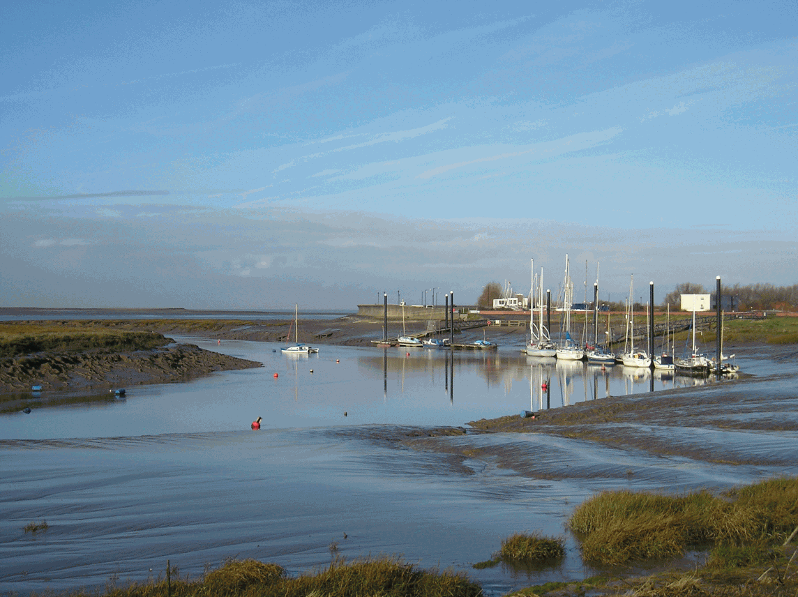
Entrance in to River Brue from River Parrett - notice build up of mud bank inside entrance. River Parrett channel marker light visible above. Entrance is constantly moving - entrance indicated by leading marks on opposite bank when entering River Brue. See sketch plan of leading marks above together with suggested course. Since this photograph was taken the channel has moved further away from the River Parrett Channel Light. (Moved further to the left) Withies and markers are in the process of being re-laid. Please check depth constantly when entering channel.

5.
Picture above as of 2007.

6.
Picture above as of 2007.

7.
Visitors will notice on entering the River Brue a series of red port hand buoys, these indicate the existence of a training wall in the sea bed, however this is covered with a bank of mud. If access has been gained in to the River Brue early, and the pontoons are not accessible it is possible to anchor in the main channel of the Brue, but care should be taken to avoid the training wall. Otherwise anchor in the River Parrett in the shelter of Steart Island, soft mud will allow all vessels to take the ground. In addition the chart shows 2.4m (MLWS) in the main channel opposite the church, however you should consider that Commercial ships still enter the River Parrett on occasions to the Port of Bridgwater and the navigable channel must not be obstructed.
Likely shipping movements can be obtained from the Harbour Master. email: harbour.master@sedgemoor.gov.uk tel:+44 01934 822666 fax:+44 01934 823111
Club Pontoons in river Brue - visitors use first set of pontoons on port side - soft mud suitable for fin or bilge keel.
WARNING
Neither the author of this site or Burnham on Sea Motor Boat and Sailing Club will accept responsibility for the accuracy of the information contained on this page. This is intended as a guide only, navigators should ensure their charts and almanacs are regularly updated. Due to the existence of mud and sand in these waters channels are liable to move

